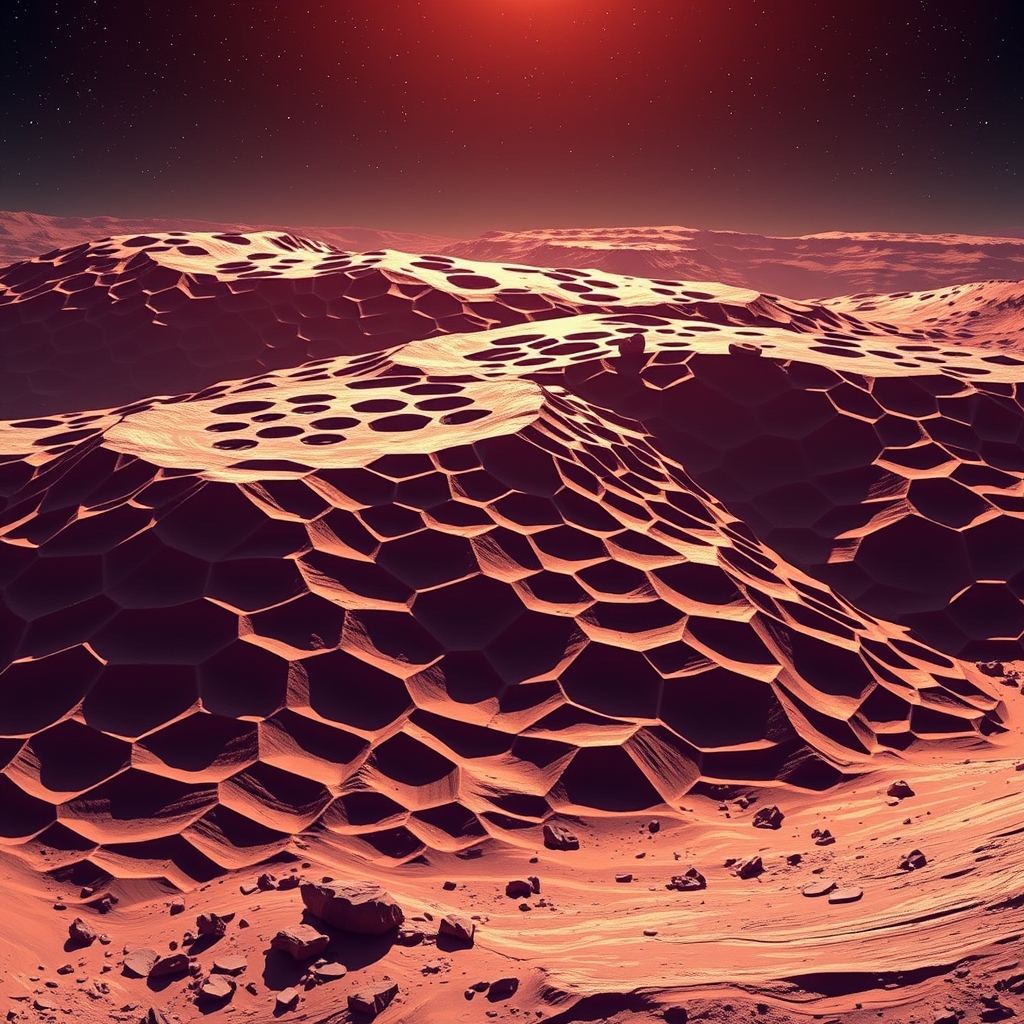
NASAのベテラン探査車キュリオシティが、ゲール・クレーター内でハニカム状の地質構造の印象的な画像を捉え、激しい科学的論争を巻き起こしている。ミッション開始から14年目にしてなされたこの発見は、多角形の隆起と謎めいた暗色の岩石を含む複雑なパズルを提示しており、火星の進化に関する現在の理解に疑問を投げかけている。
ゲール・クレーターにおける地質学的な謎
火星表面を探索中、キュリオシティ・ローバーは、巨大な蜂の巣に驚くほど似た多角形構造に覆われたユニットに遭遇した。これらの幾何学的なパターンは、以前の軌道データと比較して予想外に鮮明であり、NASAのミッション科学者たちを驚かせた。ローバーがユニットの深部へ進むにつれ、隆起はより侵食が進んでいるように見え、小石から礫(れき)サイズの暗色の岩石が点在していた。
これらの構造の起源は、依然として主要な科学的疑問である。地球では、同様の多角形パターンは、泥の乾燥、鉱物の結晶化、あるいは土壌の繰り返される凍結と融解によって生じることが多い。火星の火山噴火、水の流れ、堆積物の移動の歴史を考慮すると、研究者たちは、同様の環境プロセスがこの景観を形成したのか、あるいはより未知のメカニズムが働いているのかを調査している。
暗色岩石の謎
ハニカム状の発見にさらなる複雑さを加えているのが、地形に散らばる暗色の礫である。NASAの科学者たちは現在、アルファ粒子X線分光計(APXS)や火星ハンドレンズ・イメージャー(MAHLI)を含む高度な機器を使用して、これらの特徴を分析している。
調査の重要な点は、これらの暗い岩石が火星固有のものか、それとも地球外由来のものかという点である。有力な説の一つは、数百万年前に火星表面に落下した隕石である可能性があるというものだ。過去のミッションでは、火星上でニッケルを含む暗い岩石が特定されている。ニッケルは隕石に共通する元素であるが、火星の地殻には稀であるため、この可能性の先例となっている。他の説では、岩石が遠方の衝突によって放出されたか、あるいはゲール・クレーター内のより高い地質層から転がり落ちてきた可能性が示唆されている。
火星環境の解読
ミッションの現在の焦点は、ChemCam LIBSとRMIを使用して特定の隆起と「Cortadera」礫を標的にし、これらの特徴の化学組成を特定することにある。ハニカム状のパターンと暗い岩石が関連しているのか、それとも別々の地質学的イベントを表しているのかを理解することは極めて重要である。もしこれらの構造が、水や凍結・融解のような気候主導のプロセスによって形成されたのであれば、それらはかつて赤色惑星に存在した環境条件の間接的な証拠となり、古代の微生物生命の証拠を見つけようとする長年の探求に触れる可能性がある。
インドにとっての意味
インドがISROを通じて独自の宇宙への野心を加速させる中、深宇宙探査の進展は、国家の戦略的および科学的軌道にとって重要な意味を持つ。
- 技術的ベンチマーク: 急成長するインドの宇宙セクターにとって、キュリオシティ・ミッションの長期にわたる成功は、自律型ローバーの運用と長期的な惑星探査の技術的ベンチマークとなる。
- 科学的協力の機会: 火星探査が高解像度データ分析の新しい段階に入るにつれ、インドの科学者や学術機関が、グローバルなデータ共有や共同研究プロジェクトに参加する機会が増えている。
- 戦略的な宇宙への志向: 火星の地質学における成功は、高度なリモートセンシングや自律型ロボティクスへの投資の重要性を強調している。これらは、インドがより複雑な惑星間ミッションへと進み、世界の宇宙経済における地位を強化していく上で極めて重要な分野である。
日常を破る驚き
ローバーの最新の走行により、巨大な蜂の巣のように見える、鮮明な六角形の隆起に覆われた表面が露出した。軌道上からはそのエリアは平坦に見えていたが、間近で見て初めて多角形のネットワークが浮かび上がった。隆起は侵食によって角が取れており、その間には小石から礫サイズの暗色の礫が横たわっている。それらの予想外の豊富さと、明るい隆起と暗い岩石の鮮明なコントラストは、科学チームを驚かせた。
地球の類似例:同様のパターンがどのように形成されるか
On our planet, polygonal crusts arise in three main ways. First, when wet mud dries it can crack into a regular grid. Second, mineral crystals that grow outward from a central point sometimes produce a honeycomb texture. Third, repeated freezing and thawing of saturated soil—known as thermal contraction cracking—splits the ground into similar shapes. Each process leaves a distinct chemical fingerprint, so identifying which, if any, operated on Mars will require more than photographs.
What Mars might have done
Mars has a record of volcanic eruptions, flowing water, and shifting sediments. Any of these could have set the stage for polygon formation. A drying lakebed could have left mud that cracked as the climate dried. Alternatively, mineral-rich brines might have precipitated crystals that later eroded into the observed ridges. Freeze-thaw cycles are plausible if the region once experienced temperature swings around the freezing point of water or carbon dioxide ice.
The dark cobbles: meteorites or local debris?
Scattered among the polygons are dark rocks that could be either native Martian material or foreign meteoritic fragments. The rover’s Alpha Particle X-ray Spectrometer (APXS) and Mars Hand Lens Imager (MAHLI) are currently measuring elemental composition and surface texture. A meteorite hypothesis gains traction because previous Martian missions have found dark stones enriched in nickel—a metal abundant in meteorites but scarce in the planet’s crust. Yet an alternative view holds that the cobbles were ripped from higher strata within Gale Crater during ancient landslides, or ejected from distant impacts and later deposited here. The instruments will soon reveal whether the chemistry aligns with known meteorite signatures or matches local basaltic rocks.
Turning pictures into chemistry
To untangle the mystery, Curiosity is firing its ChemCam laser-induced breakdown spectroscopy (LIBS) system at both ridge tops and the largest dark cobble, nicknamed “Cortadera.” LIBS vaporizes a tiny spot of material and reads the resulting light spectrum, delivering a rapid elemental readout. The Remote Micro-Imager (RMI) simultaneously records high-resolution context images, linking chemistry to morphology. Together these tools let scientists test whether the ridges share a common composition with the cobbles or represent separate geological episodes.
Why Indian scientists should care
- Technical benchmark – Curiosity’s ability to operate autonomously for over a decade provides a reference point for India’s own rover development plans.
- Collaboration doors – The flood of high-resolution data invites Indian universities and research institutes to join international analysis teams, offering access to cutting-edge planetary datasets.
- Strategic relevance – Understanding Martian surface processes informs the design of future Indian interplanetary probes, especially those that will need to navigate or sample complex terrains.
Open questions and next steps
The rover will continue to map the honeycomb field, probing deeper layers to see if the pattern persists below the surface. It.